INTRODUCTION
TO BACKPACKING
Near the
trailhead
while we
take our group photo
she shares
with her cousin
who is more
like a sister
the backpack
will feel like death at first
full as it
is with all she needs for the night
and an extra
pair of boots
in case the
others give her blisters
but this
feeling won’t last and
at some
point during the hike
when she is
busy staring
at the wild
Diapensia wondering
how
something so beautiful and delicate
can flower
on the windiest of summits
the backpack
will become a part of her.
We all laugh
at this, as we shuffle our
feet and
adjust our hip belts
standing on the
hot cement parking lot
hours before
we’re sweaty and tired
and covered
in dirt and scratches
from blown
down trees along the path,
agreeing
that both are true and this
guaranteed
transformation
answers why
we keep on coming back.
At the Glen Boulder trailhead (photo by Abigail Pavelko)
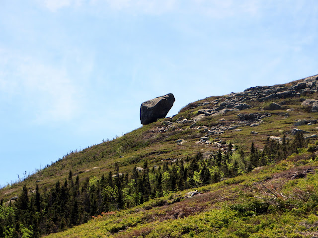
Glen Boulder
(Photo taken by Sarah Abdelmessih)
Lunch time at Glen Boulder (photo taken by Matt Giesmann)
(photo by Abigail Pavelko)
(photo taken by Matt Giesmann)
Diapensia in bloom
Still some snow in early June!
Dinner at the campsite (Photo taken by Matt Giesmann)
Sunrise, at the summit of Mount Isolation (photo by Abigail Pavelko)
At the summit of Mount Isolation
At the summit of Mount Isolation
At the summit of Mount Isolation (sign credits: Jonah Kiok-Kirsehnbaum)
Breakfast at the campsite (photo taken by Matt Giesmann)
Hike level: Moderate
Location: Pinkham Notch, NH
Driving distance from Boston: About 3 hours
Cost: FREE to hike and backpack


Comments
Post a Comment